Malpartida de Cáceres is located 10 km. west of Cáceres, in the N-521, heading to Portugal. Road infrastructure has been favored in recent years by the construction of the A-66, which runs next to the township and has signaled an exit to the township.
Lies in the midst peneplane Cacereña, being the traveler on a flat landscape of sandy soils, resulting from the disintegration of the granitic rocks of the relief actors. It is precisely in these granitic extrusions where one of our major attractions: in places where the weathering of rocks produces shapes which also are home to fauna and flora more varied. The most characteristic example of such training is offered by the Natural Monument of Los Barruecos.
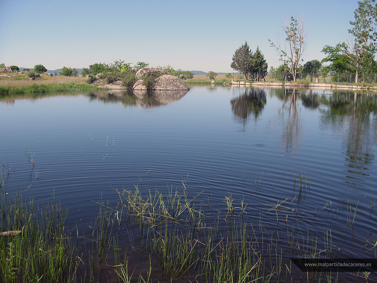
Pond Matorral
To enlarge the image click on it
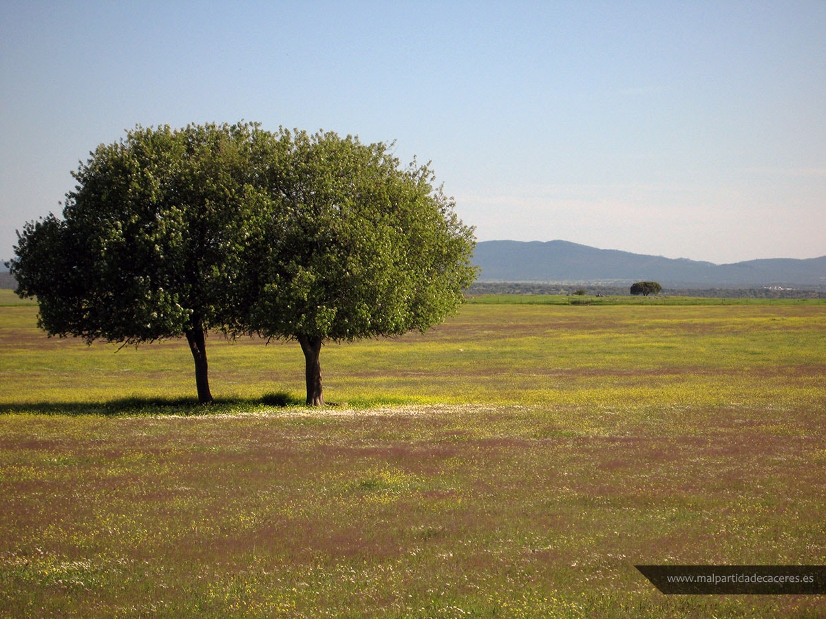
Peneplane landscape
To enlarge the image click on it
The climate is Mediterranean with Atlantic influence character. The average rainfall is set to 550 mm annually, with an irregular distribution throughout the year. Summers are long, dry and hot, while winters are rainy and mild temperatures. Without getting too high the amount of rainfall, it is surprising the abundance of pools on the ground. These granitic soils have the ability to retain rain water, so that the wells and ponds pose abundant water reserves that are maintained even during periods of drought, which guarantees the supply of livestock and wildlife stay.
Síguenos en Redes Sociales


Calendario de Eventos

Entradas recientes
-
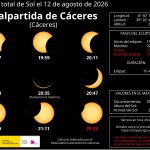
Malpartida de Cáceres vivirá el eclipse solar del 12 de agosto con actividades divulgativas y observación desde las Peñas del Corchao
El 30 de julio se celebrará una conferencia div...